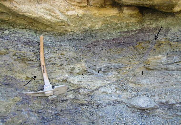
Microfractures in calcareous shale subunit of Lake Neosho Shale
Fracture surfaces in calcareous shale subunit of the
Lake Neosho
Shale. The large arrow next to the pick points to the largest fracture
surface visible here; smaller arrows point to smaller fracture surfaces.
The large arrow at the upper right shows the top of an oblique clay
dike (maroon) that extends at least three feet deep toward the left.
This is a tabular body that continues back into the exposure, so it is
not a burrow structure. The fracture surfaces are weakly slickensided,
and probably formed during differential compaction of the shale
below thickness variations at the base of the Worland Limestone.
The origin of the clay dike is uncertain. In 1999 a section of Worland
Limestone more than 100 feet long broke loose and pushed part way
across the interstate, possibly facilitated by fracture surfaces such as
these oriented more or less parallel to the sides of the highway cut.
The fractures become lubricated during significant rainfall events.
Return
to Technical Discussion
Main Menu